Last verified 2 November 2026. This is an independent record, not
a government site, and nothing here is legal, medical, or real-estate
advice.
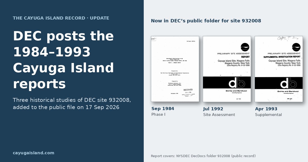
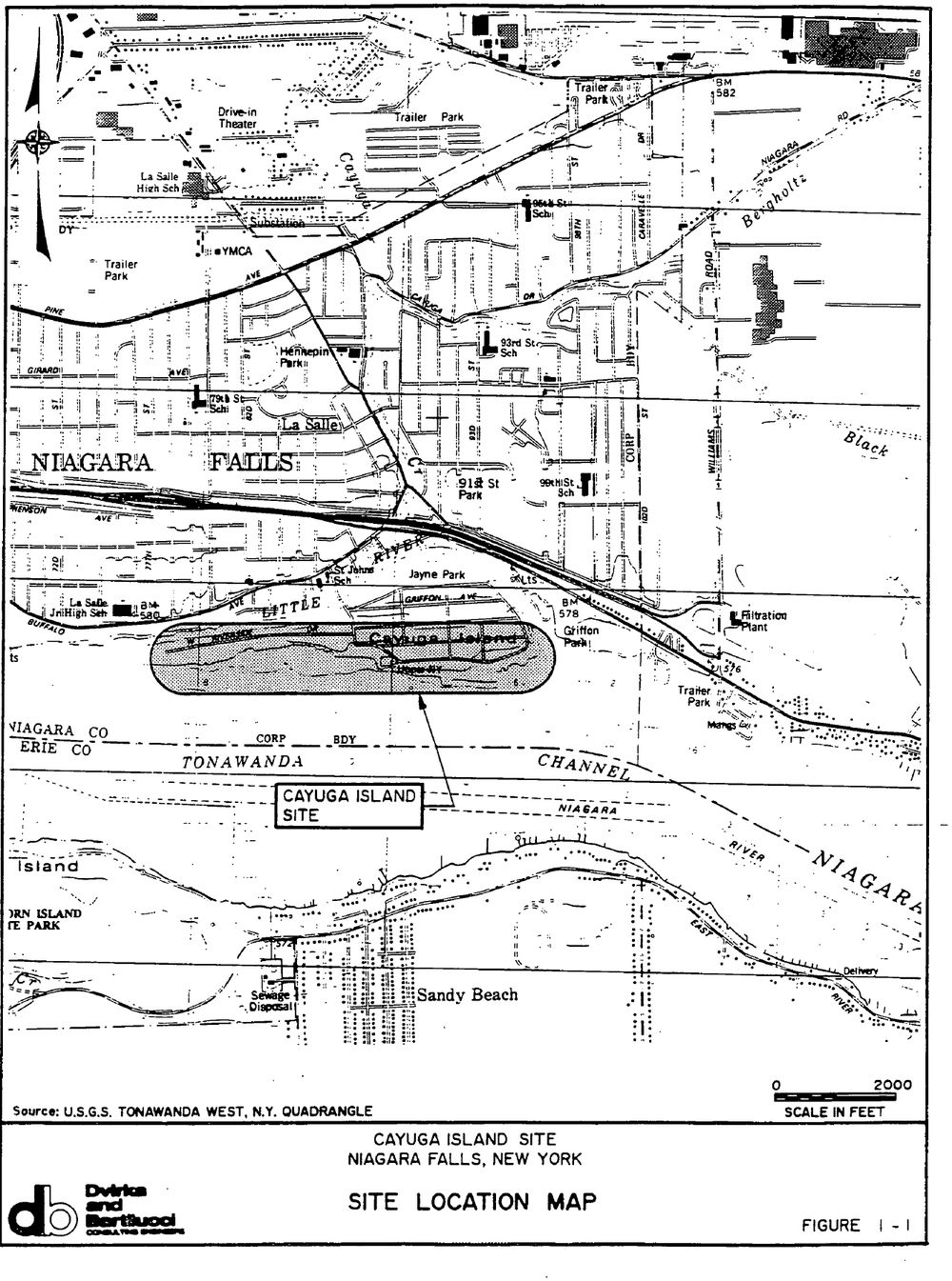
On 17 September 2026, the New York State Department of Environmental
Conservation (DEC) added three historical reports to the public document
folder for Cayuga Island, DEC site 932008. The files are dated 1984,
1992 and 1993. They are the earlier studies behind the state’s current
investigation of the island’s filled western end
(Primary: DEC folder
932008, file dates checked 2 November 2026).
We read all three: here is what each examined, what it said, and
where the records disagree. If you are new to the story, start with our
explainer, Cayuga
Island: what we know.
Key takeaways
- DEC’s Cayuga Island folder now holds five documents: two 2026 fact
sheets and three reports from 1984, 1992 and 1993. - The 1984 report was a records review. It took no soil samples and
called the fill “innocuous.” - The 1992 and 1993 studies drilled into the fill and reported
elevated mercury and pesticides in the western portion. The 1993 work
did not confirm the earlier lead and PCB results. - The reports name five companies that DEC files list as fill
suppliers. DEC has not named any responsible party.
What is in the Cayuga
Island DEC folder
All five are free PDFs (Primary: DEC folder
932008). “Posted” is the server file date (ET).
| Document | Dated | Type | Prepared by | Posted |
|---|---|---|---|---|
| Phase I Summary Report |
Sep 1984 | Records review and site visit | Ecological Analysts, Inc. for NYSDEC | 17 Sep 2026 |
| Preliminary Site Assessment |
Jul 1992 | Soil borings | Dvirka and Bartilucci for NYSDEC | 17 Sep 2026 |
| PSA Supplemental Investigation |
Apr 1993 | Borings and surface soil | Dvirka and Bartilucci for NYSDEC | 17 Sep 2026 |
| Fact sheet: Investigation |
9 Feb 2026 | Community fact sheet | NYSDEC | 3 Sep 2026 |
| Fact sheet: Expanded Investigation |
1 Sep 2026 | Community fact sheet | NYSDEC | 3 Sep 2026 |
1984: a paper review that
found “no evidence”
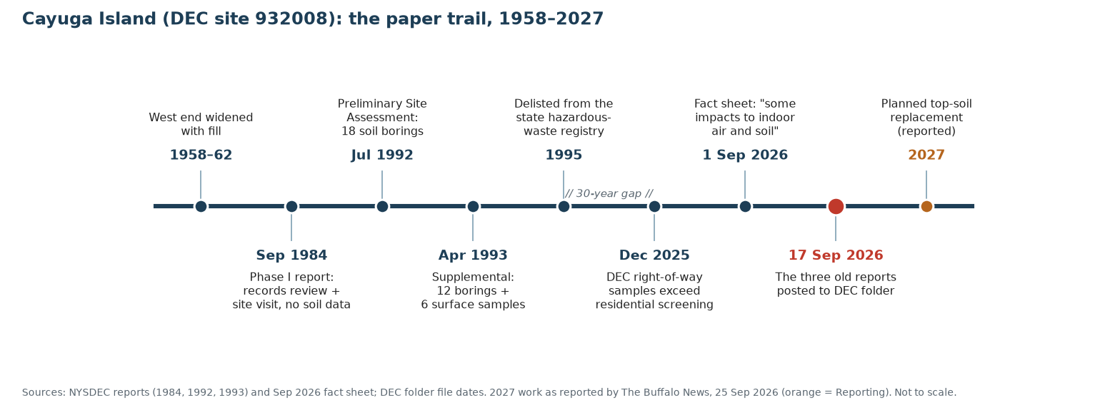
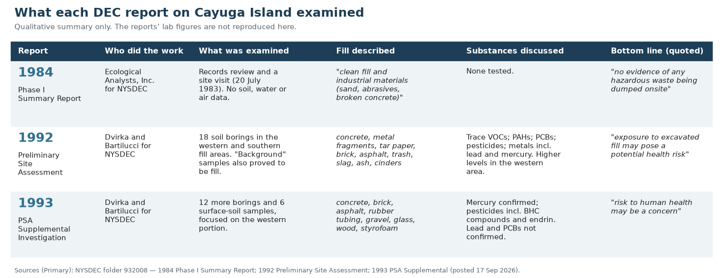
The first report was a Phase I review for DEC by Ecological Analysts,
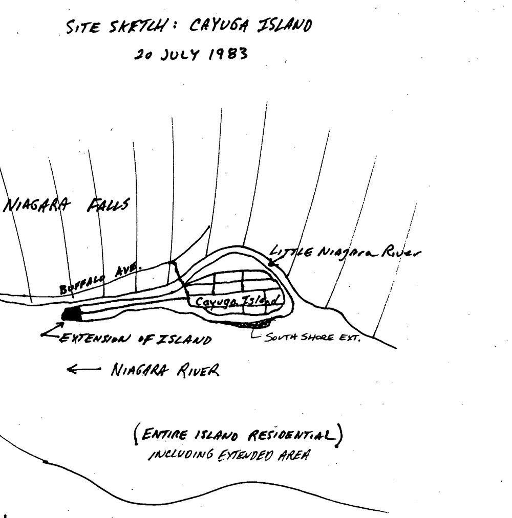
Inc. It describes the island’s west end as man-made: the western tip
“was extended 250 yards into the Niagara River prior to 1930 and later
widened between the years 1958 and 1962” (Primary: 1984
report, PDF p. 6). It adds that the soil there “consists entirely of
fill material and is, therefore, of unknown composition” and reaches
“below the Niagara River level” (Primary: PDF
p. 62).
The review relied on records and a site visit on 20 July 1983. Under
past soil sampling, it lists “No data are available”
(Primary: PDF
p. 63). Its conclusion was that “No additional investigations of the
Cayuga Island site under this program are warranted on the basis of the
available data” (Primary: PDF
p. 68).
“There is no evidence of any hazardous waste being dumped onsite.
NYSDEC records indicate the fill material as being innocuous.” — 1984
Phase I Summary Report, Executive Summary (PDF
p. 4)
The companies named as
fill suppliers
The 1984 summary describes the fill as “clean fill and industrial
materials (sand, abrasives, broken concrete).” It then says DEC files
“indicate Union Carbide, Hooker, Olin, Carborundum, and Pittsburg
Metallurgical as having supplied fill. It is believed they are part of a
larger list of companies” (Primary: 1984
report, PDF p. 4). The 1992 report repeats the five names. It says
these are the companies “who may have been the source of these
materials” and that they “are reported to be” the suppliers
(Primary: 1992
report, PDF p. 7).
These sentences record what old files said about where fill came
from. They are not findings that any company placed contaminated
material on the island, nor findings of liability. DEC’s 2026 fact
sheets do not name a responsible party (Primary: DEC,
September 2026 fact sheet). The 1992 report also says the source of
fill in “numerous small areas along the southern shore” is “unknown”
(Primary: PDF
p. 7). For how the land was built, see How the land was made.
1992: the first soil borings
The 1992 Preliminary Site Assessment was paid for by “funds allocated
under the New York State Superfund program.” Its purpose was “to perform
an investigation of the fill deposited in portions of the island.” The
consultants drilled 18 soil borings and logged “concrete fragments,
trace metal fragments, tar paper, brick fragments, asphalt, trash, slag,
ash and cinders.” They described the fill as nonhomogeneous: it varied
from one sample to the next (Primary: 1992
report, PDF p. 7).
Samples were tested for organic compounds, PCBs, pesticides and
metals. The report summarized: “low levels of contaminants were found in
the southern portion” and “elevated concentrations were detected in the
western area.” It judged that those levels “do not appear to be a health
concern based on normal use of the property,” because they were found
below the surface. It also warned that “exposure to excavated fill may
pose a potential health risk, in particular, in the western portion of
the island.” It found the fill “more extensive than originally
estimated” and recommended “a review of historical photographs”
(Primary: PDF
p. 51). That idea returned in 2026, when DEC said aerial photos
suggest filling “may have occurred further east”
(Reporting: The
Buffalo News via Chemical Processing, 25 Sep 2026).
1993: surface soil and
the pesticide finding
The 1993 supplement focused on the western portion. It drilled
“twelve borings” and collected “six surface soil samples and twelve
subsurface soil samples.” It found more of the same debris, plus “rubber
tubing, white gravel, glass, wood and styrofoam.” The “background”
samples, meant to show native soil, also turned out to be fill
(Primary: 1993
report, PDF p. 10).
Its summary says the work “did not detect elevated levels of lead but
did confirm the presence of elevated levels of mercury.” It found that
“none of the fill was defined as a hazardous waste based upon elevated
levels of metals” and that “the contamination in the fill appears to be
localized and nonhomogeneous.” It concluded that “the elevated levels of
pesticides in the surface and shallow subsurface soils may pose a threat
to human health” (Primary: PDF
p. 11). The pesticides named include the BHC compounds alpha-BHC,
delta-BHC and gamma-BHC (lindane). The report says “pesticides were
detected in all of the samples collected” (Primary: PDF
p. 29). The final conclusion: “risk to human health may be a
concern” (Primary: PDF
p. 39). DEC delisted the site from the state registry in 1995
(Primary: DEC,
September 2026 fact sheet).
We do not reproduce lab figures; see What
was found for our qualitative summary.
Where the records disagree
We show conflicting sources side by side.
| Topic | One source says | Another source says |
|---|---|---|
| Was the fill harmful? | 1984: fill “innocuous,” “no evidence of any hazardous waste” (Primary, PDF p. 4) |
1993: “risk to human health may be a concern” (Primary, PDF p. 39) |
| Lead and PCBs | 1992: elevated results in the western area (Primary, PDF p. 8, p. 51) |
1993: lead “not confirmed”; PCBs “not detected” in any supplemental sample (Primary, PDF p. 11, p. 29) |
| Which boring had the PCB result | Boring “S-5” (Primary, 1992 PDF p. 8; 1993 PDF p. 29) |
Boring “S-8” (Primary, 1993 PDF p. 39) |
| Which BHC compounds | 1993: alpha-, delta- and gamma-BHC (Primary, PDF p. 29) |
DEC’s current listing: alpha-BHC and beta-BHC (Primary, NY Open Data) |
| How big was the extension? | “extended 250 yards into the Niagara River” (Primary, 1984 PDF p. 6) |
“250 ‘acres’” of Erie Canal spoils (Commentary, J. Gary DiLaura, Niagara Falls Reporter, 27 Oct 2026) |
Since our last update
- No new DEC documents. We rechecked the DEC folder
and the Open
Data record on 2 November 2026. Both are unchanged
(Primary). - Community meeting. On 27 October, Niagara Falls
residents met at the Frontier Fire Hall about several local sites. A
Cayuga Island resident said, “I want to know if it’s my yard. I want to
know if it’s my basement” (Reporting: Spectrum
News 1, 28 Oct 2026). - The 10 November drop-in is about radiation, not the
island. EPA, DEC and DOH will hold a drop-in on Tuesday 10
November, 4 to 7 p.m., at the Calvin K. Richards Community Center. It
belongs to the Niagara and Erie County Radiological Assessment (NECRA),
separate from site 932008 (Primary: DEC
NECRA bulletin, 23 Oct 2026). For Cayuga Island contacts, see For residents.
Frequently asked questions
Where can I read
the Cayuga Island DEC reports?
All three are free PDFs in DEC’s folder for
site 932008. We list them with every other source on our Documents page.
Did the 1993 report
confirm lead and PCBs?
No. It confirmed elevated mercury and pesticides. It “did not detect
elevated levels of lead,” and PCBs were not detected in any supplemental
sample (1993
report, PDF p. 11).
Do the
reports say which companies are responsible?
No. They record that DEC files listed five companies as fill
suppliers. DEC has not named a responsible party.
Why did the 1984 report
find nothing?
It did not sample soil. It was a records review and site visit, and
it noted that no soil data existed (1984
report, PDF p. 63).
Do the old reports
tell me about my property?
We do not discuss individual properties. For your own results,
contact DEC using the details on our For
residents page.
For the full dated record, see the Cayuga Island
timeline.
Corrections: if anything here is wrong, tell us and we will log
the fix publicly on our About and corrections
page.
