
Niagara Falls, New York · West Rivershore Drive
Since DEC’s last public statement T+
What is under the west end of Cayuga Island
A water-main crew smelled something in the ground in October 2025. Eleven months later New York State has confirmed that contamination from historic industrial fill has reached the soil and the indoor air of homes on West Rivershore Drive — and has begun a second round of testing on more properties.1
This page keeps the documented record: what the agencies have actually said, what they have not, and where the accounts conflict.
The record at a glance
- Confirmed impacts
- Indoor air and soil At participating properties, per DEC’s September 2026 update.1
- Concentrations published
- None Results were given directly to individual property owners.1
- Cost to homeowners
- None Investigation, mitigation, cleanup and restoration.1
- Named contaminants
- Mercury, pesticides Plus lead, BHC, PCBs and other organic chemicals in local reporting.5
Class P means potential, not proven. DEC uses it when “preliminary information indicates that a site may have contamination” that could qualify it for the state Registry of Inactive Hazardous Waste Disposal Sites. DEC states the information for a Class P site is “preliminary in nature and unverified.” Class P sites are not on the Registry, and many are later reclassified Class N, No Further Action.2 The site is carried as DEC 932008, West Rivershore Drive, inactive hazardous waste, DEC Region 9, EPA ID NYD980507925.
Where the fill land is
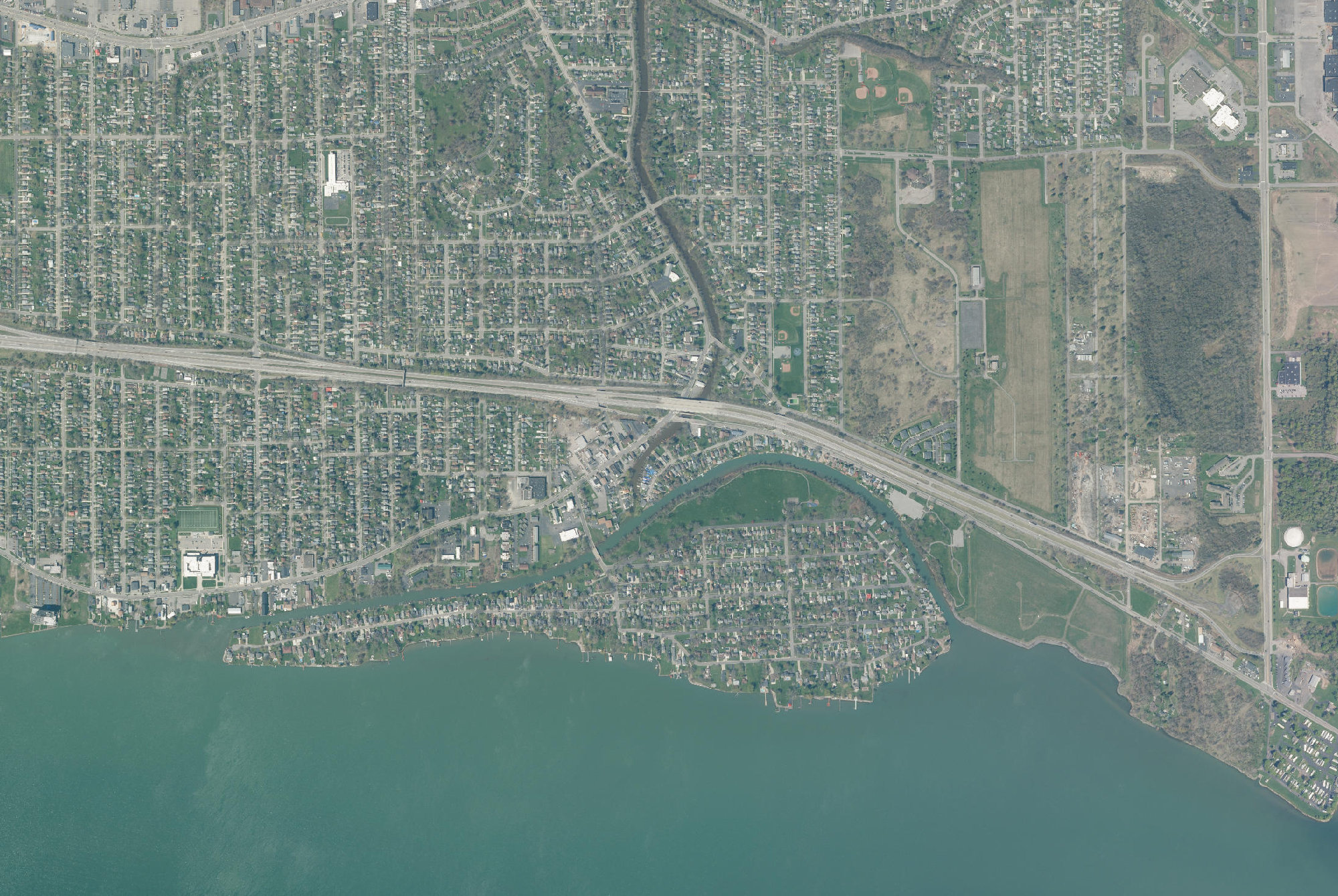
Cayuga Island sits in the LaSalle section of Niagara Falls — 140 acres, about 1.25 miles long by 0.35 miles wide, with the Niagara River along the south side and the Little River forming the north channel.7
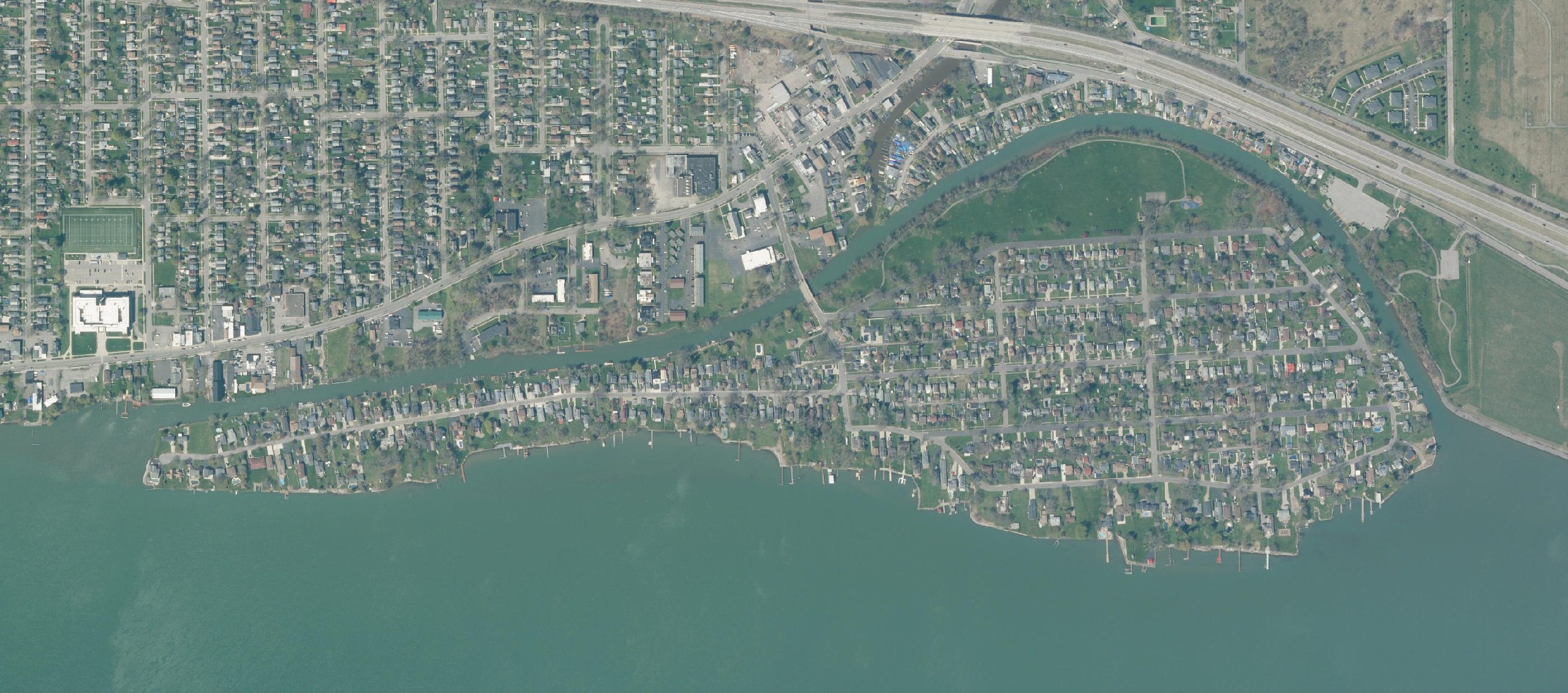
- Filled landThe westernmost 240 yards, the distance the Niagara Gazette reports the end was pushed into the river. Drawn to scale; the outline is approximate.
- Original groundThe rest of the 140-acre island.
- Griffon ParkDEC 932081, on the mainland. Class N.
The filled west endDEC says the western end was extended into the Niagara River using fill in the early 1900s, and again between 1958 and 1962 “using fill that included industrial material.” No agency boundary for the fill has been published, so the shaded area shows only the reported distance, measured from the present shoreline.Hover a feature to read it
This is an orientation diagram, not a contamination map. It shows which ground is made land, at the proportions DEC and the Gazette describe. DEC has published no boundary for the contamination and no results for individual properties, so none are drawn here.1
The newest thing on the record
DEC is expanding the investigation
On 1 September 2026 the New York State Department of Environmental Conservation posted a fact sheet titled West Cayuga Island — Site Investigation Update. It is the most recent official statement about the site and, as of this writing, has not been reported on by any news outlet.1
-
01
Contamination reached inside homes
Results from the properties sampled so far “confirmed some impacts to indoor air and soil.” This is the first time DEC has said so in public.1
-
02
Mitigation plans are underway
Property-specific plans “to address any contamination needing mitigation are underway.”1
-
03
A second phase is starting
DEC and the Department of Health “are beginning a second phase of investigations,” and offers “will be extended” to sample additional properties along West Rivershore Drive.1
-
04
None of it is billed to residents
Investigation, mitigation, cleanup, and restoring a property to its pre-cleanup condition are all “at no cost to the homeowner.”1
DEC has not published any contaminant concentrations. The fact sheet says results were “provided directly to the property owners.”1 No numbers for individual properties are in the public record, so none appear on this site.
How it came to light
A soil boring, an odour, and a file that had been quiet since 1993
In October 2025 a contractor working for the Niagara Falls Water Board drilled soil borings in the West Rivershore Drive right-of-way ahead of water-main work. The crew reported a chemical odour in the ground. Subsurface samples they sent to DEC came back with “elevated levels of several contaminants related to industrial material.”1
DEC collected its own samples from the same right-of-way and received results in early December 2025. Those results were “consistent with historical data” and showed “exceedances of DEC screening levels in residential settings for several contaminants.”1
The phrase consistent with historical data is the load-bearing one. DEC and the Department of Health had already assessed this ground in 1992 and 1993, found “sporadic contamination of mercury, pesticides, and other contaminants in surface and subsurface soils,” sent every property owner a notice with the levels, and told owners to call before doing ground-intrusive work.1 Then, on the public record, very little happened for roughly three decades.
The west end is extended with industrial material
DEC: the western end was extended again “using fill that included industrial material.” This is the origin of everything that follows.1
DEC and DOH assess the island — and notify every owner
Notices detailing contaminant levels went to each property owner, who were told to contact DEC or DOH before ground-intrusive work. This is the fact that makes the 2025 discovery a rediscovery.1
↓
2021
28 years
No investigation document for the Cayuga Island site appears in DEC’s public folder for this period. Families lived above the material without knowing. One environmental attorney called the delay “alarming” and “inexcusable.”4
A crew smells something in the right-of-way
Samples submitted to DEC show elevated levels of several contaminants related to industrial material.1
Impacts confirmed indoors; a second phase begins
Findings from participating properties to date confirmed some impacts to indoor air and soil. Mitigation plans are underway.1
The part most coverage skips
What is not known
An honest record has to say where it ends. These are open questions as of 11 September 2026, not rhetorical ones.
| Question | Status | Where it stands |
|---|---|---|
| How contaminated is any given property? | Unknown publicly | DEC gave results directly to individual owners and has published no concentrations.1 |
| How far does the fill extend? | Being determined | That is the stated purpose of the second phase of investigation now beginning.1 |
| Is there a health risk to residents today? | Under evaluation | DEC confirms impacts to indoor air and soil but publishes no exposure assessment. DOH’s Bureau of Environmental Exposure Investigation is the named contact.1 |
| Who put the fill there? | Not named | DEC’s public documents say only “fill that included industrial material.” DEC has not publicly named a responsible party. Local reporting names several companies as reported sources — see how that record reads.5 |
| Is there litigation? | None documented | No lawsuit over Cayuga Island is documented in any source indexed here. One environmental attorney has criticised the regulatory delay in print; that is commentary, not a filing.4 |
| What happens to property values? | No analysis exists | No published analysis exists. Anything on this subject would be speculation and is not published here. |
Cayuga Island is regularly described as a Superfund site. It is not one. It is a DEC Class P site — under investigation to determine whether it qualifies for the state Registry — and EPA has determined it does not qualify for the federal National Priorities List on existing information.23
Why the comparison gets made
Where the accounts disagree
Three unresolved conflicts in the record
These are not errors in anyone’s reporting so much as gaps between an agency’s summary and a reporter’s sources. We lead with the primary record and show the other account rather than quietly picking one.
When the industrial fill was placed
The western end was extended “in the early 1900s and again between 1958 and 1962.”1
We use DEC’s dates and note that the range may be wider.
When DEC last looked, before 2025
DEC’s own fact sheet points to site assessments in 1992 and 1993.1
The last DEC investigation was completed in 1984, following a joint EPA and USGS report that year, with further testing and soil advisories in the 1990s.4
Both can be true of different activities; neither account has been reconciled publicly.
Whether there is any danger at all
Urging residents to cooperate: “If you can’t identify the extent of the issue, you’re not going to come up with a solution.”6
“There is no danger on the island about any toxic waste interfering with your way of life. Period.” A former FBI agent with expertise in metals and organic compounds, he says his own historical soil tests found only compounds consistent with fertiliser or pesticide use.6
We report both positions and adjudicate neither. DEC’s September 2026 statement that impacts to indoor air and soil were confirmed at participating properties is the only agency finding currently on the record.1
Broadcast coverage
What the television reporting showed
Television reports from the weeks after the sampling began, and one resident commentary. None is an agency source, and nothing in any of them is treated here as a finding.810
The third video argues this site is comparable to Love Canal. That is the speaker’s view, not this record’s: Cayuga Island is a DEC Class P site, not a Superfund site, and EPA has determined it does not qualify for the National Priorities List.23
Nothing is requested from YouTube until you press play. Until then these are still images only. Pressing play loads a player from youtube-nocookie.com.
Sources on this page
Every claim above traces to one of these. Agency documents are linked directly, not summarised second-hand.
- NYSDEC, West Cayuga Island — Site Investigation Update (fact sheet, 1 September 2026), site 932008. Primary
-
NYSDEC, Site
Classifications; site record from NY Open Data,
Environmental
Remediation Sites,
program_number 932008. Primary - US EPA, Superfund site profile: Cayuga Island LF, EPA ID NYD980507925. Primary
- Mark Scheer, “Two decades since DEC last probed Cayuga Island contaminants”, Niagara Gazette, 20 June 2026. Reporting
- Mark Scheer, “DEC: chemical sampling underway on west end of Cayuga Island”, Niagara Gazette, 15 June 2026. Reporting
- Dave McKinley, “Investigation into Cayuga Island contaminants continue”, WGRZ, 17 June 2026. Reporting
- Niagara Falls USA, Griffon Park & Boat Dock; Wikipedia, Cayuga Island — island dimensions and channel names. Background
- WGRZ-TV, “DEC investigating chemical contamination on Cayuga Island in Niagara Falls” and “Investigation into toxic pollutants found on Cayuga Island launched by DEC”, broadcast reports, June 2026. Reporting
- NYSDEC document folder, site 932008, Cayuga Island — the folder holds no investigation document dated between 1993 and 2021. Primary
- Doc Holliday WNY, “Cayuga Island: the City of Niagara Falls NY has a potential Love Canal situation”, resident commentary. Included as a record of what is being said locally; its Love Canal comparison is the speaker’s and is not adopted here. Commentary
Stay with the record
Be told when this changes
A new agency document, a correction, or a change in the investigation. No more often than the record actually moves, and nothing else.